Quantcast
Channel: Jack Elliott's Santa Barbara Adventure
Viewing all 283 articles
Browse latest View live

Carrizo Tom

$
0
0

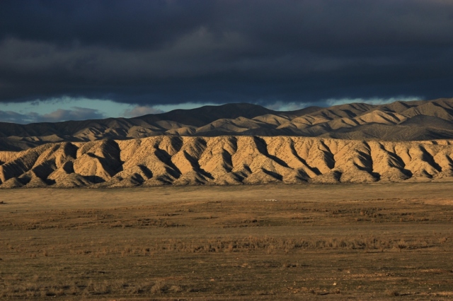
418 YBThe Carrizo Plain in the hinterlands of San Luis Obispo County, CA as seen from atop the

I first drove the road 12 years ago. Over the years since then I’ve seen more pronghorn antelope than people out thataway. One midafternoon I came upon a guy hunched over the engine of his broken down truck. Unless I turned around I had no choice but to drive by him. I didn’t want to stop, but I couldn’t rightly pass him by. It was at least a half day’s walk to the closest thing that might be called civilization, which was little more than a few trailer homes. The temperature was in the nineties and the only trace of shade around fell in thin stripes behind fence posts and blades of dried grass.

I rolled to a halt in the middle of the road, turned off my engine and stepped out. He leaned around the raised hood of his battered old Ford peering at me through two slits in his sun-puckered raisin face. “Need a ride?” I said. He looked at his rig, the ticking of my hot engine punctuating the heavy silence. I wanted him to say no. He raised and let fall four fingers that drummed one after the other across the top edge of his raised hood. “Yeah,” he said. I considered him with renewed interest trying to assess whether or not I just invited a psychopath to sit a foot away from me in the middle of nowhere. I had to be the good Samaritan didn’t I? Should’ve been the cynical bastard that just drives on by.

The golden valley shimmered before us in the radiance of summer as we drove up the plain. The truck filled with the sour fumes of metabolized alcohol that seeped from his tiny exhaust pipe pores and billowed from his cracked lips with the few words he uttered. He said he lived out there. More like survived. Who the hell would live out there? What type of person? The land probably looked the same a thousand years ago just without the barbed wire and dirt road. There was nothing around. I scanned the barren plain wondering if he meant he actually had a house of some sort. Maybe a thin sheet metal wrapped hovel with rotting tires and tin foil pressed against the windows for curtains, a collection of empty bottles piled about its interior.

With a few points of his finger and a couple of mumbled words we ended up at his friend’s house, a lone outpost in the midst of the valley. I pulled up to a locked metal gate just off the dirt road and a man behind it halted whatever he had been working on to glower at me. A lush garden erupted triumphantly from the soil around his double-wide trailer in defiance of the arid climate. A storage shed stood connected to the mobile home by a long overhang that provide a covered workplace and various large tools and equipment dotted the yard. A flag pole poked into the sky, its banner waving lazily in the light breeze. It was a terrestrial spaceship, a self-contained survival unit existing in the vast space of the plain.

If the long distance from others wasn’t sufficient division then the imposing institutional barrier enclosing the parcel made the separation unequivocal. The strictness of the enclosure cast and uneasy vibe across the otherwise serene openness of the plain. Sequestered from the metropolitan community in a wasteland, and locked behind the suspiciously tall fence walling off his frontier fort oasis from the outside world, the man staring at me obviously wasn’t accustom to strange visitors much less appreciative of outside company. Was it wise security measures by a self-reliant resident of the boondocks, paranoid reclusion or militant defense of the unwarranted?

My passenger slid from the cab muttering his thanks once more. “What’s your name?” I asked just before he swung the door shut. “Tom,” he said. Later that afternoon on my way home, on back down the plain, I drove past Tom in his truck being pulled with a ratty old rope by his friend in his truck. Nobody waved.

Soda Lake RoadA road less traveled on the Carrizo Plain.


Oyster Mushrooms

$
0
0

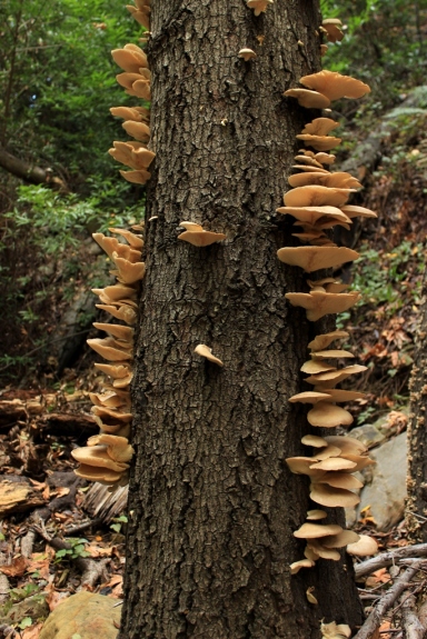
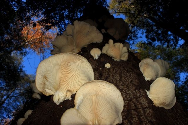
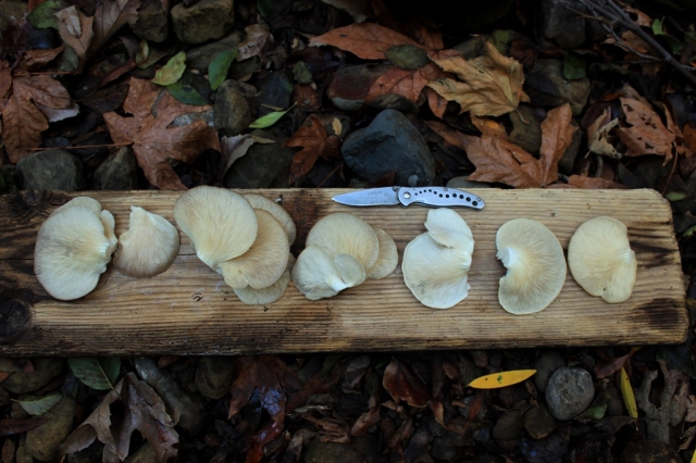
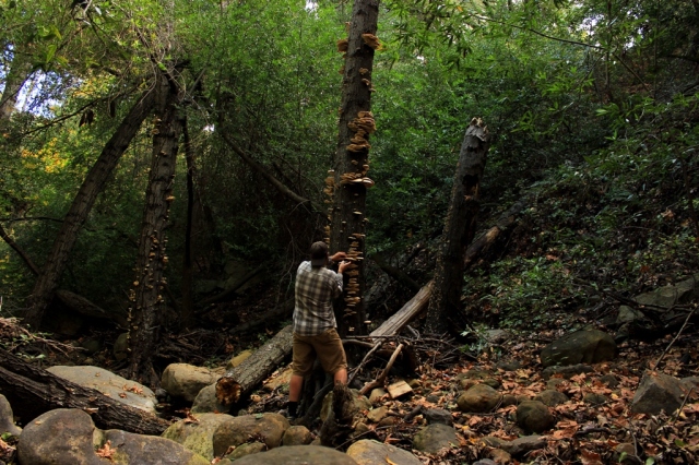
oystersHarvesting oyster mushrooms in the mountains of Santa Barbara County.

I’m just some lunatic macaroni mushroom, is that it?

Joe Pesci

With recent rains having finally fallen after the usual long dry period in these parts, and the winter transformation of the dry, brown and crispy woodland into a moist and verdant environment of fresh new plant growth, the wild mushrooms have sprouted. I have been making my early season rounds to favorite harvesting sites and taking home some choice wild edibles. My latest pull has been a few oyster mushrooms.

oysters 4

oysters 3oysters 2My humble harvest. Though oyster mushrooms regrow on the same logs year after year and as such provide a sustainable source of food, I see no need to take more than I plan to eat.

Related Posts:

Chanterelle Mushrooms

Hericium Mushrooms

Giant Puffball Mushrooms

Gem-studded Puffballs


Ice Company Ads (1920s)

$
0
0

This post is an addition to a previous entry about the history of the ice can stoves found in California’s Los Padres National Forest (The Ice Can Stove: A Brief History). These are makeshift wood burning stoves made from old sheet metal molds once used to freeze water into blocks of ice. The advertisements from local companies were originally published in the Santa Barbara Morning Press in the 1920s.

The first ad below shows a sketch of an ice block in the form of the metal ice can mold it was produced in. “The finished cake is taken from the can,” the ad notes, “and accurately scored into 25 and 50 pound blocks. . . .” As described in the aforementioned post, it was those metal molds, or ice cans, that were used to fabricate the ice can stoves.

Ice Note the telephone number.

ice 2An ad celebrating Santa Barbara’s Old Spanish Days Fiesta.


Gibraltar Rock Waterfall

$
0
0

A seldom flowing waterfall in the Los Padres National Forest, below Gibraltar Rock, on a small tributary of Rattlesnake Canyon creek.008 YB.1waterfall117 YBThe pool at the foot of the falls.


La Cumbre Peak Snow

$
0
0

East Camino CieloEast Camino Cielo Road in the Los Padres National Forest.

A light snow dusted the crest of the Santa Ynez Mountains above Santa Barbara yesterday afternoon. Although it was Saturday, the low cloud cover hugging the peaks kept the snowy mountaintop from being visible from town, which seemed to keep the crowds away.

On my way up a snowy Gibraltar Road I came across a guy straddling his Harley with his back tire caught in a small drainage rut beside the road. He had apparently tried to pull off the slippery road to turn around in a snow covered dirt shoulder and ended up with his tire in the low spot, which he couldn’t throttle or push out of. I stopped to help push him out of the rut and got him on his way as the snow continued to fall.

La Cumbre Peak snow 2.1La Cumbre Peak

La Cumbre Peak snow rocks

La Cumbre Peak snowThe picnic area atop La Cumbre Peak (3995′) with Goleta visible far below and the Pacific Ocean.


Chorro Grande Falls, Snow Frosted Pine Mountain

$
0
0

Chorro Grande Falls with Pine Mountain Ridge in the background, Ventura County California.Chorro FallChorro Falls


White Ledge Peak, Santa Ynez Mountains

$
0
0

White Ledge face White Ledge Peak, the dots noting our route.

From Home to Hills

I waken in the three o’clock hour after four hours of sleep and shuffle across the cold creaky floor, flick on the heater and proceed to the living room to dress. Despite my chronic mild dehydration, I pour yet another pint of stiff coffee, dump in a couple glugs of low-fat milk and place the diuretic concoction into the microwave. I grab my gear and haul it outside. Returning to the kitchen, I force down a pint of fresh water, grab my steaming coffee cup, hit the lights and slink out the front door into the cold dampness of the predawn hours. Being up and at ‘em this early, and heading somewhere I’ve never been before, puts a thrillful tinge on what would otherwise be an ordinary average transit from home to hills along boring traveled-too-many-times roadway.

Sometime later I meld into the seat of Stillman’s (David Stillman’s blog) truck as we zip along the asphalt ribbon to the trailhead. We’re on our way toward the tilted, chaparral tufted sandstone slab known as White Ledge Peak eastward from Carpinteria and westward from Ojai. We don’t know if we’ll make it to the top of the peak, but that’s not something I’ve thought about. We arrive and park sometime in the latter half of the four o’clock hour, gather our gear and necessities, and begin marching by the moonlight of a waxing gibbous.

White LedgeEarly morning look up the creek at White Ledge.

Barging the Creek

We walk through moonlit darkness for an hour or so. Some places are illuminated enough to see where to walk, other places are swallowed by ridge line shadows and oak trees, but I walk quickly, ready for a stumble, feeling my way by foot as much as by sight, trusting that the way is clear and that I’m on it. Sometime just after five a.m. a shriek pierces the morning silence. It sounds like a large bird being eaten alive, but as I stop for a closer listen, and the thud of my footsteps and heavy breath fade, I hear the distinct but subtle voice of a cat within the eerie cry. It’s a mountain lion.

Sometime after sunrise we’re busting our way through the dense riparian tangle of the creek that drains the face of White Ledge. It’s slow, tedious hiking forcing our way through the alleyway of viny brambles and brush, over and around cascade after waterfall, after waterfall after cascade, after cascade after waterfall. I misplaced my gloves so I’m fighting my way through the plant choked drainage barefisted tearing my hands up.

I’m barging through brush, the branches raking across my shins and arms, judging how hard to push through it based on the level of pain it causes. Slight scratching and I’m crashing through it all. A branch digs into my thigh and I slow trying to force my way through without pushing it further into my flesh, and then it pokes sharply at my leg bringing me to a sudden halt.

I’m climbing over branches, crawling through them, and under it all. Short sections of a footpath emerge before disappearing into walls of dead fallen limbs, but there is no signs of humans just bear scat. Hiking the incline through the creek takes much effort and energy. It’s frustrating at times as vines catch my ankles and seem to pull me backwards, as branches bend like rubber rather than snap in half to let me by, as I loose my footing on pitches of bedrock thinly covered in leaf mulch, as I slam my shins into logs and rocks, as thorny patches of wild rose leave me feeling like a pin cushion. I’ll be squeezing festering thorns and splinters out of my flesh for days afterward. The creek leaves me with numerous bloodied scratches and a few spots of blood on my thigh, which have soaked through my pants and are the size of a couple of dimes and a nickel. And then we finally begin to emerge from the riparian jungle.

White LedgeStillman hiking up the bouldery gulley that drains the face of White Ledge.

The Rocky Ascent

We break out of the brushy creek near the foot of White Ledge and begin the haul up the steep rocky gully, which runs along the seam where the slab of the peak meets the chaparral covered mountainside. It’s more strenuous hiking, but with added boulder hopping and scrambling. I step on patches of soil that cling to the angled slope and they disintegrate under foot crumbling away. My foot pushes through the thin layer of dirt and hits the steep slope of the underlying sandstone and begins sliding, which throws my balance off and I teeter, straining for traction and stability with every muscle clenched. It saps my energy struggling against the pull of gravity. Some sections I hike without much thought as on autopilot, while others require undivided attention to avoid slipping and tumbling like a rag doll down sheer rock faces. Lather, rinse and repeat all the way up the mountainside. It wouldn’t take much to get hurt or worse.

Most of the morning passes with the day’s objective of reaching the summit remaining a questionable uncertainty. And then as we close in on the far upper portion of the peak it becomes clear that our chosen route will indeed lead us to the top. Not far below I had begun anticipating reaching a dead end like a box canyon, where the gully would end encircled by loose cliffs that signal the end of our endeavor or at least this particular route. I finally break free from the rock slope and head into boulders and chaparral finding my way to the pinnacle.

The summit consists of a rocky edge that juts into the sky running roughly east to west. It offers exceptional circular views of the surrounding region. It is a real peak, a true summit that requires a legit ascent, as I imagine what the three words should properly mean. It’s not just some ordinary high point in the hills. Hiking to the summit feels like a true feat, not merely walking a wide-open well-traveled uphill trail. White Ledge Peak is a one and only original. Though an old sun-faded and weathered, small wooden cross is stuck into a rock pile, we find no summit register and so place one we brought with us and sign in.

We spend some time atop the mountain. The gauzy presence of clouds and haze and the poor lighting make taking decent photos nearly impossible and it obscures an otherwise supreme 360 degree view. Much of the low lying lands below us are pale in the shadows and undefined.

White Ledge Steep and loose.

White Ledge A view from about halfway down a series of five waterfalls.White Ledge Higher up the waterfalls.

WHite Ledge 10The waterfalls of White Ledge, which we climbed, scaled or scrambled our way up.

White Ledge The west peak rears up like a jacking reef break.

White Ledge Stillman in the distance standing on White Ledge summit.

White Ledge summitSummit view looking toward Divide Peak and Peak 4864 or what somebody named King’s Crest.

White Ledge

Stillman ledged up while heading down. We had to back track a bit to get down to the slab of White Ledge.

The Return

Plodding down slope on our return we naturally cover distance quicker and it’s not long before we plunge back into the dense riparian cover of the creek. It seems to go on and on, and on. I mistake a set of bedrock ribs framing the creek, over which it flows in one of the many waterfalls, for the place near where we depart the canyon. My misreading of the land makes the already long, laborious march through the brush seem all the longer.

This second pass fighting our way through the creek is brutal. I’m dragging my feet, stumbling, sliding out and getting tripped up more frequently. Vines snare my feet as I wade through the thicket and sap disproportionate amounts of energy from my depleted reserve, as they force me to strain against them to hold my balance and free myself. Fatigued and with rubbery legs, I recognize the increased risk of injury and redouble my effort to trod more deliberately. But I just want to rail through the mess and get the hell out. I’m bloodied, bruised, scraped and punctured, thirsty and hungry. It’s a peculiar strain of fun.

We finally emerge from the canyon and sit for a final rest before completing the last segment of our return hike, the miles of which are counted on more than one hand. I draw on my drinking tube and hear the gurgles of an empty water bladder, but I’m too tired to bother tramping back down to the creek. I reckon that in the cool weather and fading light I’ll make the last long leg of our journey without suffering too much from a lack of water. I’ll keep my mouth closed as I hike, as usual, to lessen the amount of moisture lost while exhaling, and I’ll hold a pebble in my mouth to help keep it moist, and hope to avoid a dehydration headache. And I know I have a liter of sugary sports drink back in the truck. The sun is sliding toward the horizon and we end up hiking in the dark for the last hour or so. Fourteen hours later we triumphantly make it back to our ride.

White Ledge Stillman below the twenty foot ledge mentioned in the previous photo.


Manzanita Flower Tea

$
0
0

Manzanita flowersManzanita flowers.

Manzanita is flowering at the moment. The Chumash Indians ate manzanita berries or fruits by preparing them in a variety of different ways and other Native Americans used the leaves for medicinal purposes. The wood was used by some to smoke fish.

The fragrant flowers can be gathered and soaked in water overnight to make a sweet tasting infusion. While the flowers themselves have an astringent, mouth drying taste, Mazanita infused water has a pleasant, delicate floral flavor.

Manzanita

Related Posts:

Holly-leaved Cherries, Eating Fire Roasted Yucca, Oyster Mushrooms, Los Padres Tree Lobster, Giant Puffball Mushrooms, Chanterelle Mushrooms


Godwin Canyon, Los Padres National Forest

$
0
0

GodwinThe gateway to Godwin Canyon.

I hiked up Godwin Canyon a few days ago. It’d been about a year since I’d been up thataway and in that time somebody slapped together some sort of sloppy grow set-up. I came across six 20 pound bags of granular chemical fertilizer, a 12 pound box of Miracle-Gro and a two-cubic foot bag of potting soil. It was all lying along the dry creek, beside the faint trail that runs through the area, without any effort to conceal it. A little farther along I came across a length of 1/2-inch black irrigation tubing strung waist high across the creek. One end of the hose ran into the brush while the other end was strung up along a hillside of exposed soil and in plain sight. It was a goofy looking operation.

Godwin CanyonIcy cascade, frozen pool.

Godwin CanyonFrozen creek.

Godwin CanyonFrozen creek.

Godwin CanyonGodwin Canyon


California Condor

$
0
0

California Condor

Stillman condor featherDavid Stillman at large in the SLP with a wing tip primary feather from a California condor measuring over 18 inches long. The condor is North America’s largest flying bird and can have a wingspan of over nine feet. Considering the size of the feather held by Stillman in relation to the condor in flight, soaring with its wing tip primary feathers spread, gives some sense of the big vulture’s remarkable size.

Related Post:

California Condor Timeline of Tragedy


Tequepis Canyon Falls, Santa Ynez Mountains

Potrero Seco Camp, Dick Smith Wilderness, Los Padres National Forest

When In France

$
0
0

(Guest Post)French Riviera

France is one of the most popular tourist locations in the world, receiving more than 82 million foreign tourists annually. The country is famous for its pristine locations that are both rich in culture and agreeable in terms of climate.

Before you start your adventure, it is important to be well rested. In order for you to fully appreciate the iconic tourist spots, a good day’s rest is crucial. You may try online gaming portals like Partypoker.fr to save you time on trips to casinos and other gaming locations. The relaxing benefits of a good poker game in the comfort of your own hotel room can be a great way to wind down as the day ends. Unlike casinos where you can find it very hard to leave, online poker can be abandoned just as easily as signing up.

There’s also a possibility that you might win some money you can use as extra funds for your vacation. Apart from the obvious financial possibilities of online poker, the vast community of local players can give you tips and advice on great locations you can visit while on tour. Local travel websites and international ones like Touropia and TouristSpots list the top 10 tourist destinations for novice travelers.

To avoid crowded locations like the Louvre and the Eiffel tower that are always full of tourists, try visiting other locations that are just as significant and beautiful. Locations like the Palace of Versailles, which was home to the Kings of France before the French revolution. There are also exotic locations like the Dune of Pyla located near the Archachon Bay, where the coastline is hugged by a sea of pine trees. Exciting adventure locations like the Gorge du Verdon where you can enjoy kayaking, sailing, and water skiing in dazzling emerald green waters. The Chamonix is also a good choice if you prefer a colder climate for skiing, mountain hiking, and biking. One other location, more preferred by artists, fashion models, and millionaires is St. Tropez located in the heavenly French Riviera. After you’ve visited all of the great locations in France, then I would ask you to take your chances at the Louvre and the Eiffel tower. This way, you will maximize your time and visit more locations during your stay.

France is more than just glamour and fashion. The country in itself is a haven for inspiration, relaxation and has the perfect melody of all seasons in its climate. Set no schedule for yourself when visiting. The tides, cool wind, warm people, great wine and food have the tendency to make you stay longer than intended.


Dragon’s Back Ridge, Carrizo Plain

$
0
0

Carrizo Crossing Coiled barbwire on Carrizo Plain

I drove out to the Carrizo Plain National Monument after a few days of intermittent rain showers. It is a semi-arid grassland of several hundred thousand acres that remains today, for the most part, as it was hundreds if not thousands of years ago. That alone, in the nation’s most populace state of California, is perhaps a remarkable enough trait in itself to warrant a visit by backcountry gadabouts, those who appreciate the simple pleasure of roaming freely within vast, open natural spaces and unspoiled landscapes. The nearby San Joaquin Valley, by contrast, has been carved up into a patchwork of farm fields, ranches and subdivisions.

I go to the Carrizo Plain when I feel like escaping the artificial metropolitan bubble of humanity and its hurried masses, but don’t feel much like hiking. I enjoy the plain’s winter ambiance, after seasonal rains dampen the dessicated terrain and when the temperatures are cool and lumpy gray clouds float overhead. It is a place I cherish for its serenity and desolation and its palpable silence. At first glance, upon my initial visit years ago, it seemed like a wasteland of little interest, but over the last decade I have developed a rather keen appreciation of its many subtle and dramatic characteristics and the natural and anthropological wonders found there.

cow boneSun-bleached bone on the plain.

The San Andreas Fault runs through the eastern side of the plain forming the appropriately named Temblor Range. It is here that on January 9, 1857 the 7.9 magnitude Fort Tejon earthquake resulted in a 30 foot offset in Wallace Creek, which can be seen today in the arroyo’s dramatic z-shaped meandering course.

While the northern side of the Temblor Range is sparsely dotted with juniper, the southern face is barren due to the lack of rain. The result is a starkly beautiful landscape with sections of badland terrain. Perhaps the most prominent example of this barren landscape is found in Dragon’s Back Ridge, which has formed as a result of the tremendous pressure created along the San Andreas Fault, where the Pacific Plate and North American Plate slide passed each other.

On this most recent trip I took a walk across the width of the plain and on up to the top of the Dragon’s Back. I had hoped to see some pronghorn antelope or perhaps a San Joaquin Kit fox, but, alas, no such luck. I saw nothing larger than a single jackrabbit speedily bounding away from me. I passed by several empty vernal pools in this relatively dry year, but not much else.

I passed over a couple of undulations in the otherwise flat plain, and as I proceeded farther into the depths of the plain, I turned regularly to look back and note my location relative the distant Caliente Range, which defines the southern flank of the Carrizo Plain, and for some time my truck was hidden from sight.

Later, while on top of the Dragon’s Back, my truck was barely visible and only when the light hit the metal and glass just right to cast a reflection. My vehicle looked puny, a mere speck, against the vastness of the grassy plain. It was not easily seen, which despite carefully surveying the landscape on my way to the ridge to avoid becoming lost, made it easy to lose my place of return.

Of course, use of a GPS would have rendered such concerns irrelevant, but I prefer not to rely too heavily on such technological crutches. They are convenient and handy, but no substitute for real skills. And I also find it more entertaining and satisfying finding my own way rather than having my eyes glued to a machine.

DragonsApproaching Dragon’s Back Ridge.

Dragon’s Back is comprised of a long line of steep gullies and pointy ridges along it’s southern slope. These ridge lines are steep sided and the tops typically span roughly some three to six feet across and form a sort of ramp that can be walked up and down. Animal trails run along each of these pointy ridges or spines and in certain locations here and there atop the main ridge lie piles of animal poop like that of coyotes or foxes. It is clearly an active location though I saw no life. The top of Dragon’s offers commanding views of the Carrizo Plain.

In late afternoon dark clouds condensed over the ridge casting a deep shadow over the plain. My truck no longer reflected sunlight and it disappeared from sight. As I headed down the ridge back to the plain I took a bearing on a prominent feature of the distant Caliente Range, which corresponded to the location of my truck, and headed toward it hoping not to stray too far from where I needed to go.

As I made the final approach to where I had parked, a hole formed in the dark cloud blanket overhead and a bright shaft of sunlight shown from above on my truck like a giant spotlight. I turned for a last look a Dragon’s Back and the golden light of late afternoon illuminated the ridge against a blackened backdrop of thick cloud cover.

Dragons Back Walking up one of the spines on the ridge.DragonsLooking west from the top of Dragon’s Back.Dragon's BackLooking east at the ridge I walked down to get back to the plain.

Dragons raptors nestA raptors nest in what might be the only tree on the Carrizo Plain, Dragon’s Back Ridge in the background.Dragons Dragon’s Back in the golden glow of late afternoon sunlight.

Red Tail hawkA Red-tailed hawk I flushed off the ground when checking nearby Soda Lake prior to visiting Dragon’s Back.

Dragons

Related Posts:

The Carrizo Experience: Ten Hours on the Plain I: Ruminants on the Range.
The Carrizo Experience: Ten Hours on the Plain II: The Bedrock Mortars of Selby Rocks.
The Carrizo Experience: Ten Hours on the Plain III: Pictographs of the Plain
The Carrizo Experience: Ten Hours on the Plain IV: Soda Lake
Wallace Creek Offset at the San Andreas Fault
Cave’s Eye View on the Carrizo Plain
Summertime Soda Lake
Soda Lake Winter Reflections
Elkhorn Plain
Selby Rocks
Carrizo Plain Wildflowers
Datura Bloom on the Carrizo
Carrizo Tom


Cachuma Mountain, Los Padres National Forest

$
0
0

View from Cachuma Mountain The view looking at Hurricane Deck from Cachuma Mountain on Monday afternoon.

Cachuma cachuma Looking east from the slope of Cachuma Mountain.

cachuma The, or a, route up Cachuma Mountain.

cachuma A butterfly decided to fly through the frame.

cachuma It kept circling around and landing near me.

cachuma A panoramic of Manzana Creek drainage.

cachuma USGS summit benchmark.

cachumacachuma Cachuma Mountain from across Santa Ynez Valley.


Alice Keck Park Park

$
0
0

Alice Keck Park Memorial Garden

I went to Starr King preschool in downtown Santa Barbara, which is across the street from Alice Keck Park Memorial Gardens shown in the photo above. As a little kid I came to know the public ornamental gardens as Alice Keck Park. I continued to know the garden park by that name well into my adult years. Then one day I finally came to understand that the lady after which the public gardens are named had the last name of Park. So, it’s Alice Keck Park Park. . .


California Campin’ Surf Shot

Astray Again on White Mountain

$
0
0

White MountainWhite Mountain on the far right.

It had been almost twenty years since I last made the short hike from Gibraltar Road to White Mountain. A couple of friends and I hiked up to its rocky crags for an afternoon spent exploring the boulders and caves. As the sun was setting we began heading back. By this time we weren’t seeing or thinking too clearly for one reason and another and we soon lost the trail which disappeared before us. We began combing the area in the fading light searching for the route off the mountain but nobody could find it. Then finally, while off alone pushing my way through the brush for some time, I located the trail and was able to lead the crew back to our vehicle.

On a recent Wednesday afternoon I parked on Gibraltar and took the same unmarked route up a small ravine that leads to the east flank of White Mountain. Off and on throughout the few hours I was out I thought of my last adventure on the mountain and how we barely made it off. It was due to luck brought about by unflagging effort that I had finally crossed over the trail and made it back to the car. It was an amusing experience to think back on as I climbed through the chaparral and manzanita now greatly thinned from recent wildfire and still regrowing. Little did I know I was about to repeat the very mishap that I underwent some 20 years earlier.

White Mountain White Mountain

I arrive at the rocky crags and sparse pine trees and begin a leisurely look around, scrambling up and down gritty sandstone faces, crawling through tunnels and caves and climbing atop some of the more prominent monoliths. I find a sizable rock riddled with little caves that weave through its innards like mole tunnels, and that has a half bowl-like alcove facing due west looking into the sun, which is by now low in the sky but still above the horizon. I find a comfortable spot and lay back against the warm stone on this cool winter afternoon, pull some snacks from my pack and relax taking in the view of the rocks and pines and the Pacific Ocean thousands of feet below.

I don’t get much sleep these days. It comes in bits and pieces and I’m lucky if I get four hours of intermittent sleep a night. Up on the mountain, one minute I’m lounging on the rock nibbling snacks and the next thing I know I waken. Upon opening my eyes I’m startled and in my sleep fogged mind I’m confused to see how dark and shadowy my surroundings are. A second later I realize that’s because the sun is actually sitting half below the horizon about to sink into the sea. I frantically grab my gear together, sling my pack on and begin charging over the rocks hopping boulders back to the trail.

Despite my concern, the sunset over the coast is too beautiful to ignore so I turn and snap a couple of shots with my iPhone. I know the light will begin fading rapidly and I need to move quickly, but I walk only a bit further before stopping for more photos. As I head onward I’m relieved to find the faint path through the fire regrowth. Just follow it back, simple as it gets, right? But less than a minute later a bad feeling ripples through me. I anticipate the trail disappearing into the darkness of twilight. And sure enough I’m comfortably walking the path one second and in another few ticks of the clock I lose it.

white mountain This is about as wide open and obvious as the trail gets in one of the more densely grown areas. Other sections have much less brush and more open soil, which makes this lesser walked unmarked use trail no easier to find in fading light.

I double back and find the path and reorient myself. But I quickly lose the trail where the bushes sprout from the ground in spotty tufts with bare soil surrounding each clump of brush. The trail is indistinguishable from the myriad natural paths formed by the open soil between all the brush clumps, which grow several feet apart. I stop and look over the land before me trying to decide where the trail would most likely lead. It’s getting dark quickly and I need to find my way posthaste. I try to pick out a path but it’s a futile attempt. It’s already too dark to see far in front of me. I carry on at a fast walk looking for any sign of the trail, but nothing shows so I continue in the general direction I feel is the correct way.

I’m no longer concerned. I’m somewhere beyond that. I know maintaining a calm, collect mental state is essential, and I’m not panicking, but I’m thinking nervously about the possibility of not being able to locate the trail before twilight ends and night swallows the land in blackness. I’m starting to sweat with beads percolating up on my brow. I’m wandering in a meander around a sloping hillside searching in vain. I reason that I can’t afford to waste any more minutes searching in circles for the path and so start pushing through the knee-high, sparsely growing brush down the ridgeline that I’m confident I came up. I hope to pass over the trail eventually.

White Mountain

I scamper up over a rock slab and spot a four inch thick chaparral limb long ago sawed in half. I’m thrilled to see the sign and keep heading down slope, but I end up in a wall of brush. I turn right and push my way through the area of least resistance for twenty yards before accepting that I’m going the wrong way. I head back, quickly but deliberately, a slight jog to the sawed limb, and I start again down slope following what I think may be the trail. But once more I end in the same wall of brush.

Twilight is fading as I run back up the semi-clear route I twice followed to no avail and relocate the sawed limb. This time I head uphill and it feels like the right way. It’s open enough to walk without too much resistance. This could be it. But it quickly ends and once more I’m mentally groping around in the thickening darkness.

For the next several minutes I circle around but find no sign of a route. I try this way, that way, this way and that way again. I end up in the same couple of dead ends so I stop to consider my options. I have to make a choice and I feel it will be decisive. It will either lead me out or doom me to fumbling through the brush in utter darkness or worse, huddling through a long cold night. Do I search for the trail? Barge through the brush down the ridge to where the trail might be cutting north back down to the road? Or bust my way through the dense chaparral in front of me toward where I believe the road lies?

This is ridiculous. Absurd! My mind sets aside the search and my thoughts turn to self-denunciation. I can see the city lights. I can see cars with their headlights on driving up Gibraltar. But I’m effectively lost. Walled in by chaparral. I know where I need to go, but I can’t get there because I lost the thin trail through the impenetrable bramble. This is just pathetic! ******* idiot!

I pull my cell phone from my pocket and see that I have reception, but only 14% of my battery remaining. I turn it off just in case I am forced to use it at 3:30 in the morning when I’m shivering my way toward hypothermia in the winter night with only a short sleeved t-shirt on and thin nylon pants. Even then I don’t know that I’d call. I really don’t want to suffer through a long bitter night on the mountain, but I’m a big believer that what one gets themselves into they must, if at all possible, get themselves out of without relying on help from others. Self-reliance not dependence. Anything but dependence. I despise dependence with pathological contempt.

I’ve mentioned elsewhere on this blog that “I’d rather spend a cold miserable night lost in the woods and have another try at finding my way out next morning, rather than call for help. I’d die sooner from embarrassment than exposure.” And this case on White Mountain is no different. There was no way in hell I was going to call for help! If I couldn’t find the second, alternative trail out that leads in from the north, then I’d call my wife and let her know I had some dues to pay for my stupidity and that I’d see her tomorrow morning some time. Maybe I’d call a friend to come up the trail and give a few shouts to guide me back. Worse case, I’d find a cave in the rocks to hunker down in, start a small fire and shiver my way through the night.

Of my options I’m pondering which choice to make. Only a slight, faint glow of sunlight remains and I only have time for one option. And so I make the call. (To be continued. . .)

white mountain


Astray Again on White Mountain II

$
0
0

(. . .continued from Astray Again on White Mountain I)

White Mountain Late afternoon view looking east from White Mountain.

“The general rules of life clearly state that if you’re ready for something, it won’t happen and if you ain’t ready, it sure will happen!”

—Mykel Hawke, Captain, U.S. Army Special Forces

And so it is I come to be wandering a darkened mountain slope searching for the trail without any of my usual basic supplies; no headlamp, no warm clothes and no emergency vacuum-metalized polyethylene blanket. I don’t have my GPS because I feel it is a crutch, a form of cheating. It represents in some sense the very sort of mind numbing creature comfort of civilization which I seek to escape when I walk into the woods.

I’m straining to see in the the faint trace of remaining twilight. It will be pitch black in minutes. I decide to walk on through the brush in the direction I think I need to head, but meet overhead chaparral within yards. I might as well try climbing through a tangle of barbed wire. I cast a long thoughtful look down the ridge, and decide to follow it.

I have no idea where the trail is other than it’s somewhere close by lost in the deepening darkness. I do know with absolute certainty, however, that the ridge leads to the road. If I follow the ridge for a couple of hundred yards it will lead me to the road just a short walk below where I parked. When it gets totally dark, only a crescent moon rising but not until well after 11 pm, and I can no longer see much of anything, I plan to guide myself along the ridgeline by referencing the lights of Santa Barbara far below on the coastal plain.

I settle on the plan and start barging down the sloping ridgeline through knee to waist deep brush, while wondering how thick it will get, and if in darkness I’ll have to resort to brutal, bare-handed bushwhacking. Later in the night, I find deep bloody gouges on my shins testifying to my hurried charge through the brush and the pain numbing adrenaline that was coursing through my body.

White Mountain I bust my way through the wiry chaparral moving farther down the ridge following the line where the shorter fire regrowth meets the wall of older, unburned overhead chaparral. I come to yet another impenetrable wall of brush. My plan is already failing. I retrace my steps as best I can in the dark and try again but end up in the same dead end. Standing there contemplating whether to try climbing over and through the brush, I can see another slight rise in the mountain in the direction I want to go, which means that’s not the way to go. This is bad. And getting worse.

I decide to turn rightward, and head down toward the southern edge of the ridge, toward the sparkling city lights because it’s the path of least resistance. A burst of confidence rushes over me. I feel that the trail in fact runs below me, and that I was too high on top of the ridge, and that I’m not as far down the flank of the mountain as I had previous thought. I had been looking for the 90 degree turn in the trail northward back to the road, but I was still way too high up the mountain. The trail is still far down the ridge. That’s my reckoning and I go with it.

Within twenty yards I break out of boulders and waist deep brush and onto the trail. Despite several wrong decisions, I had worked my way through the muddle based on my memory of the hike in, the rock outcrops passed and the lay of the land which were still discernible in the darkness, and a vague feeling of where the trail should logically run. I hurry on down the ridge trying to remain on what little trail there is and thinking how close I came to being stuck on the mountain. I’m elated. I keep walking quickly, but my good feeling shrivels as I realize just how high up the mountainside I am and how far off the mark I had been. I still have a long ways to go down the ridge before the trail cuts northward toward the road, wherever that may be.

My I made it! feeling turns to Not so fast, jackass, you still very well may not find your way back. And indeed, I lose the trail. Once more I’m barging through the brush up and down and over and back and around trying to find it. It’s too dark to see any path at all and I’m just searching for something, anything that might clue me into to where I need to go. I don’t know if I passed the turn off to the road or if I need to continue down the ridge. It’s the most difficult position I find myself in thus far: Do I continue down or return back up? Eeny, meeny, miney moe. Which way do I go?!

White Mountain

After two unsuccessful pushes farther down slope I run uphill trying to find the last place I felt like there was possibly a trail. I see a tunnel heading into the brush, a black hole, and I charge over and into it. It’s an instant dead end. But as I stand up from my doubled over position and cast a look out of a break in the brush I see the road. And my truck. It’s right there not much more than a stone’s throw away. It’s a huge break. Even if I don’t find the trail now, I’ll rip myself to shreds if need be to get through the chaparral and down to the road.

I run out of the brush tunnel and head up the slope once more tearing through knee to waist deep chaparral. I come to an area of tall, thick brush and spend a few seconds wondering which way to go. I pace back and forth trying to find a passable route before jumping in without regard. I tear through into more open terrain and work my way along the edge of overhead chaparral when I come upon a piece of trash. It’s an old wad of white paper gleaming in the blackness.

Where it not for the piece of paper I likely wouldn’t have seen the trail. It was too dark, the trail an unmarked obscure hole through the overhead brush. I remember seeing the trash when I first came in. I step over the paper and into the brush tunnel, and slide down the gravely ravine through the leaf mulch, and break out onto the asphalt of Gibraltar Road with a nervous chuckle of relief. I raise a clenched fist in the air and pump it back and forth in triumph as I walk up the road.

“On my way home!” I text my wife. “Fell asleep. Woke up, sun was setting. Lost trail in dark for awhile.”

“Great to hear,” she replies.

White Mountain Santa Barbara, the Pacific Ocean and Santa Cruz Island


Coyote Gulch Waterfall, Utah

Viewing all 283 articles
Browse latest View live


<script src="https://jsc.adskeeper.com/r/s/rssing.com.1596347.js" async> </script>